Use a GPS to track your photos
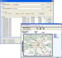
PixGPS is a simple program for Microsoft Windows that makes it simple to insert the exact position of each photo (latitude and longitude) into the photos EXIF meta data.
All you need is a digital camera that stores EXIF inside the image file (most cameras do this) and a GPS Receiver that can store track logs in GPX format.
PixGPS makes it easy to geotag your digital photos. Just download the photos from your camera and get the GPX formatted track log from your GPS Receiver. The PixGPS Geotagger will in matter of seconds calculate the latitude and longitude for each of the photos. It will store the latitude and longitude in each photos EXIF meta data so it will stay with the photo.
Operating system:Windows 2K / XP / Vista / 7

MagicBD is a graphic software which can be used to draw many kinds of iconographies, illustrations and sketch maps.It can also be used to edit images to process them or get some special effects.
Price: $28, Rating: 10, Downloads: 234
Download
Pos Free Photo Editor is a free photo editor from the authors of the best free professional photo editor - Photo Pos Pro free photo editor. The software is simple and very user friendly photo editor, that lets you easily view, and enhance your photos
Price: $0.00, Rating: 10, Downloads: 190
Download

Design over 10 photos by few mouse clicks. Easily create photo book, collage, calendar, greeting cards, wedding photos and more artworks.
Price: $39.95, Rating: 0, Downloads: 171
Download
Citra FX is a photo filter effects software.
Price: $ 29, Rating: 10, Downloads: 162
Download
Image Frame is a Photoshop-compatible plug-in for easy creation naturally-look 3D frame. Add frame and text to your photos. You can apply rectangular and elliptical frame, change frame profile, material, and lightening.
Price: $14.95, Rating: 10, Downloads: 160
Download